Client
Town of Tiburon, California

A GIS-enabled climate resilience engagement for a California coastal municipality, aligned with state sea level rise guidance and regional adaptation frameworks.

Six fixed parameters defining scope, jurisdiction, and engagement model for the Tiburon sea level rise adaptation program.
The Town of Tiburon needed to assess and address escalating risks from sea level rise and coastal flooding, with planning processes requiring stronger climate resilience measures aligned with California state guidance.
Smart Fusion, serving as technology subcontractor, delivered GIS-based vulnerability analysis, adaptation strategy development, stakeholder workshops and surveys, and draft and final technical reporting integrated with municipal planning processes.
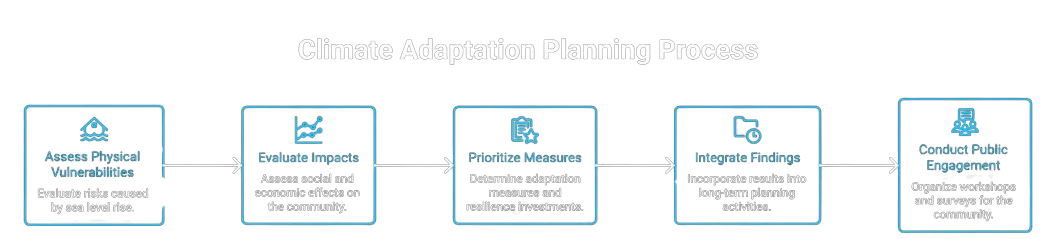
The engagement produced a structured framework for identifying vulnerabilities and prioritizing adaptation measures, supporting community engagement and long-term climate resilience for the Town.
A GIS-enabled methodology anchored on vulnerability analysis, adaptation prioritization, and stakeholder-informed planning.
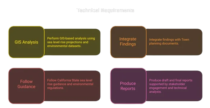
Each deliverable was prepared to support municipal planning integration and state climate resilience compliance.